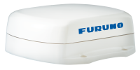
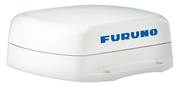
FURUNO SCX-21 Satellite Compass NMEA0183
Order number: NN-IMD036670AADelivery time Auf Anfrage Workdays
Description
Product Description and Technical Data
Revolutionary Baseline Architecture
Utilizing four separate GNSS Antennas for the ultimate in responsiveness, the SCX20 and SCX21 set a new standard for reliable and accurate heading for all of your marine electronics. Traditionally, a Satellite Compass™ calculates heading using one baseline between two antennas; the SCX20/21 four antennas can calculate heading information using any one of the six baselines drawn between the four antennas.
The unprecedented quad-antenna design of the SCX20 and SCX21 makes them capable of calculating extremely accurate heading, pitch, roll, and heave information. They are the perfect heading solution for complex vessel installations where the view of satellites may sometimes be obstructed.
Experience superior accuracy
The SCX20 and SCX21 enhance the performance of on-board equipment such as Radar, Fish Finders, Sonar, and Autopilots. Accurate heading information empowers your NAVpilot to keep a better course, saving time, fuel, and money on every voyage; meanwhile, precise pitch, roll, and heave information stabilizes the display for many Furuno Fish Finders and Sonars, allowing for an accurate presentation even in the roughest of seas.
Precision Navigation Data to any NMEA2000 Network
Full NMEA2000 Certification provides plug and play connectivity to any NMEA2000 network. Distribute high-accuracy navigation data as well as air temperature and barometric pressure. Initial Setup and configuration can be done from any Navnet TZT2/TZT3 MFD, Navpilot 300, or use the free Furuno SC Setting Tool PC Software when properly interfaced.
- Perfect for NavNet TZtouch MFD*, NAVpilot-300*, and WASSP installations
- *NMEA0183 - NMEA2000 converter required
- Outputs accurate Time, Position, Heading, COG/SOG, ROT, Roll/Pitch/Heave 3-Axis Speed, Air Temperature and Air Pressure data
- Unprecedented heading accuracy for Radars, Sonars, and Navigation
- Utilizes four Multi GNSS (GPS, QZSS, GLONASS, Galileo) antennas
- 1.0 degree heading accuracy, 0.02 knot speed accuracy
- Lightweight antenna - only 1.0kg!
Specifications
- Frequency: 1575.42 MHz (GPS/Galileo/QZSS/SBAS) / 1602.5625 MHz (GLONASS)
- Tracking code: C/A (GPS/QZSS/SBAS), E1B (Galileo), L1OF (GLONASS)
- Heading Accuracy: Heading/Roll/Pitch: 1.0° rms (static) 0.5° rms (dynamic)
- Follow-up: 45°/sec
- Settling time: 60 seconds approx.
- Position Accuracy: GPS: 5m approx. (2 drms, HDOP < 4)
MSAS: 4m approx. (2 drms, HDOP < 4)
WAAS: 3m approx. (2 drms, HDOP < 4)
- Interface: 3 Ports NMEA0183, Tx 3 Ch, Rx 2 Ch
1 Port PPS, RS-485, rising edge detecting
- Temperature: -25°C to +55°C (storage: -30°C to 70°C)
- Waterproofing: IP56
- Power Supply: 12-24 VDC: 0.2-0.1 A
Documents
Manuals, Data Sheets, etc.
- DE - Prospekt PDF Download
- EN - Brochure PDF Download
- ENG - Operator Manual PDF Download
- ENG - Operator Manual SC Setting Tool PDF Download


